Routing
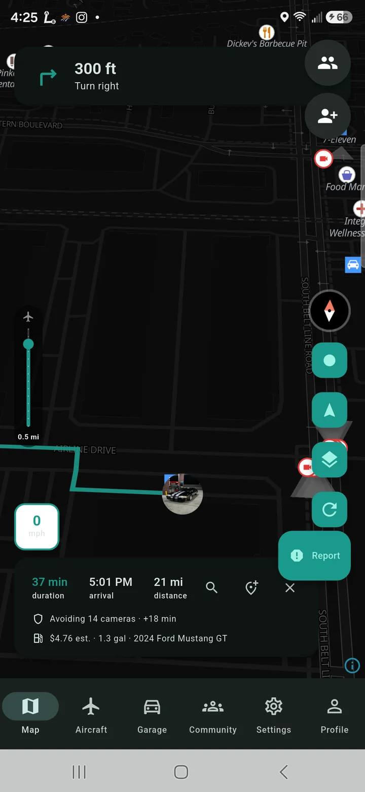
Camera-aware routing
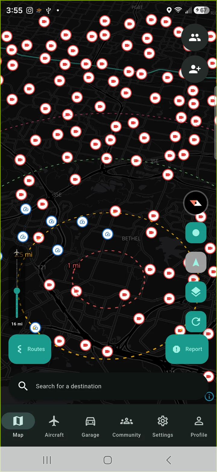
Automatic plate readers (ALPR) are mapped in the open, and RoadSignal can take them into account when it plans a route. Turn it on and it prefers roads with less of it; leave it off and you get an ordinary fastest route. Tap any camera to see who operates it and what it records, set your own avoidance radius and buffer, and see the dataset's count and freshness in-app.
Map
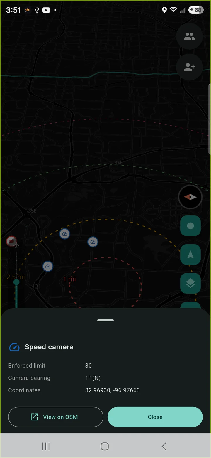
Enforcement cameras on the map
Fixed speed and red-light cameras, each with the limit it enforces where that's recorded. Shown by default; avoidance is opt-in and off by default, because knowing where enforcement is helps you drive to the posted limit.
Community
Community road alerts
Drivers report hazards (eleven subtypes), collisions, closures, cameras, congestion and police; everyone nearby sees them. Reports expire on their own and can be voted down, queue offline and send when you're back in coverage. Add public road-work feeds by URL (WZDx work zones from state DOTs); overlapping reports collapse to one marker.
Alerts
An alerting engine, not a beep
Proximity alerts with severity bands and a speed gate. Nine channels — tones, bogey sound, vibration, banner, system notification, map markers and more — configurable per alert type: eight types by nine channels. Background alerting (opt-in) keeps watching when the screen is off. Snooze and hold-time, same-street-only or combined strategy, cluster de-duplication, muted places, suggested lockouts for spots that alert you every day, and import of your existing JBV1 settings.
Airspace
Aircraft overhead
Live ADS-B positions of aircraft above you, cross-checked against the public FAA registry so tail numbers show on the map, with flagging for aircraft of interest. Aircraft alerts use the same channel matrix as everything else.
Map
Heat maps
A police-hotspot heat layer fed by community reports, plus any SABRE plugins you add. See where reports cluster before you're in the middle of them.
Weather
Weather radar
NOAA/NWS precipitation overlay on the map. US coverage, no forecast layer — just what's falling now.
Navigation
Turn-by-turn navigation
Voice guidance, speed-limit sign, a route summary line ("via US 177 → I 35"), multi-stop routing, and search with favorites and Home/Work. Twelve POI categories nationwide, with gas results tagged with the fuel your car actually takes. Map style is independent of app theme: light, dark, satellite, or follow-the-app.
Group
Convoy
Start a session, share a code, everyone sees everyone in real time. The leader's destination and stops sync to the group, with a status board per member (speed, distance, driving/arrived). Ghost mode hides you from the group when you want it; joined / left / arrived / off-route events each get their own notification toggle.
Community
Clubs
Create or join, public or private, and find clubs near you. Roster and roles, club chat, invites, opt-in mutual live location between members, club events with RSVP, and club-scoped leaderboards.
Social
Feed and inbox
A community feed with world / friends / club scopes, likes, and attachable routes and events. Direct messages with blocking. Reporting and a moderation queue behind both.
Routes
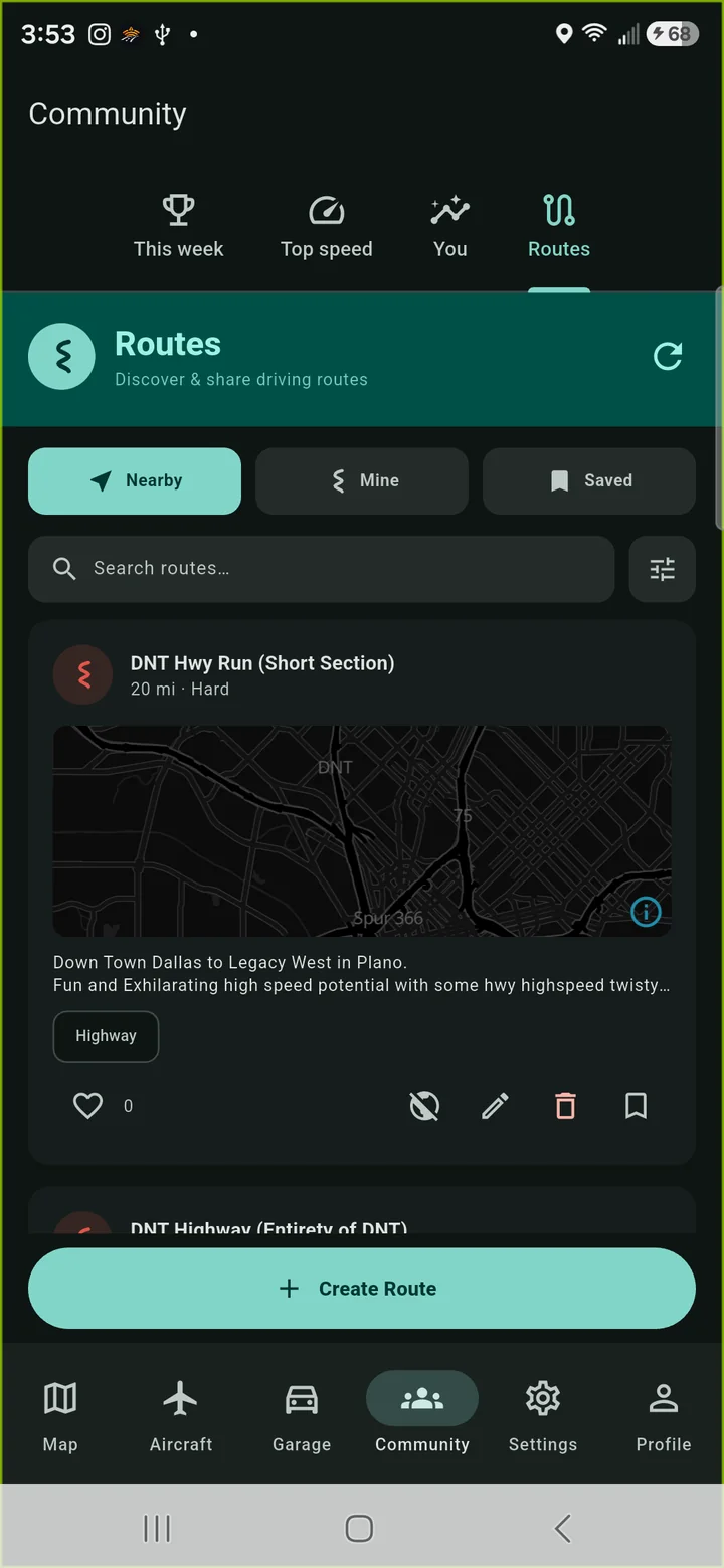
Routes
Build one on the map or record one by driving it, with difficulty, road type and public/private. Browse routes near you, save them, run time trials against them and replay the trace.
Telemetry
Drive log and telemetry
Every recorded drive keeps its stats — fifteen of them, measured from real sampling rates rather than guessed. Weekly leaderboards (global, friends, club) with a podium and your rank pinned even when you're off the board, plus all-time stats.
Garage
Garage
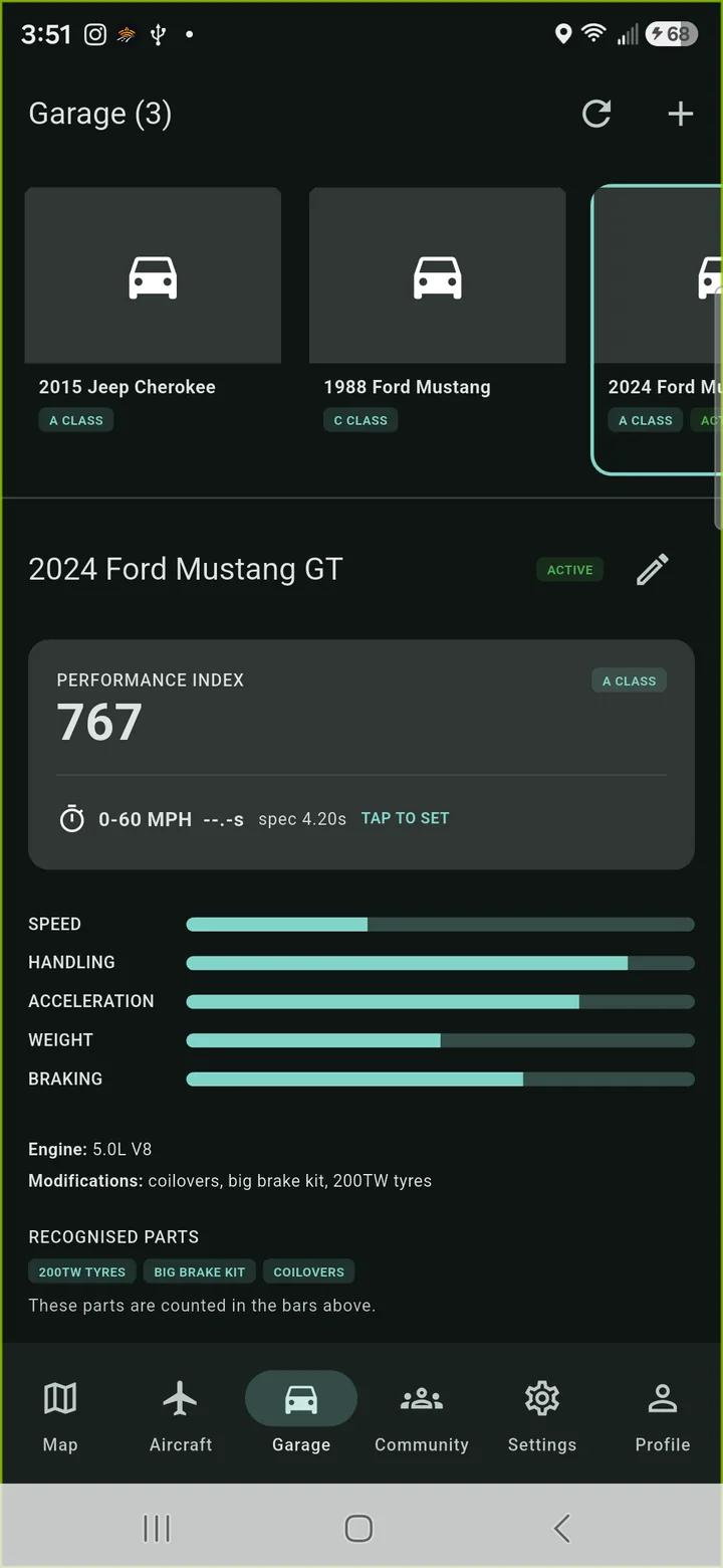
Cars and motorcycles with real specs and mods, a photo, and a performance index computed from what you enter. City/highway MPG and fuel grade, so a trip's fuel cost is priced against the vehicle you're actually driving. Public or private per vehicle.
Voice
Voice control
Push-to-talk, on-device only. If the phone can't recognise speech locally it refuses rather than sending audio to a cloud.
Privacy
Privacy by default
No ads, no analytics, no crash-reporting SDKs — none. No account to start; when you do make one it's pseudonymous by default, with per-stat visibility toggles. A home-base privacy zone clips the start and end of anything you publish so your driveway never leaves your phone. Delete your account from inside the app in two taps.
Settings
Settings that scale
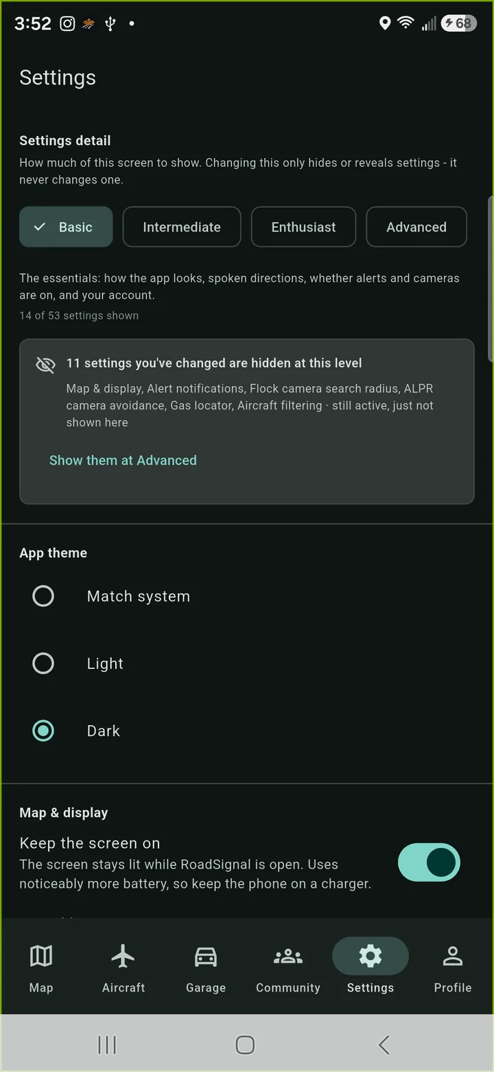
Basic shows eleven controls; Intermediate, Enthusiast and Advanced show progressively more of the ~45. Save and share settings packs, switch them automatically by geofence, and back up your preferences to your account.
Add-on · recommended
Extra alert sources (SABRE)
Optional, and worth turning on. RoadSignal includes a SABRE plugin host, so separately installed alert-source apps can feed sightings in through one open contract — they land as map markers, raise proximity alerts and feed the police-hotspot layer on exactly the same rules as a driver report. RoadSignal ships the host only: it bundles no plugins, and which ones you install is your call.